


TEXAS
COAST AERIAL
PHOTOGRAPHY
High resolution digital copies of many of these photographs are available for sale. You may purchase a digital photo in the highest resolution that I have for $25.00 for personal use or for use in your presentations. The charge will be $150 for use in publications or for commercial reproduction. Contact me to purchase photos. These photographs are copyrighted and are the property of Richard L. Watson. They may not be copied or used without permission. You may however link to this website from your website or by email.
These photographs are copyrighted and are the property of Richard L. Watson. They may not be copied or used without permission. You may however link to this website from your website or by email.
If you would like to make a donation to help support the expense of providing these photos of the Texas Coast, please click on the Paypal button below.
Read the following report for much more information about the entire coast.
Coastal Law and the Geology of a Changing Shoreline, March 2006, updated to include section on poor beach and dune management practicesA Packery Channel and Beach Closing Blog.
http://packery.blogspot.com/
Did they remove the bar at the entrance?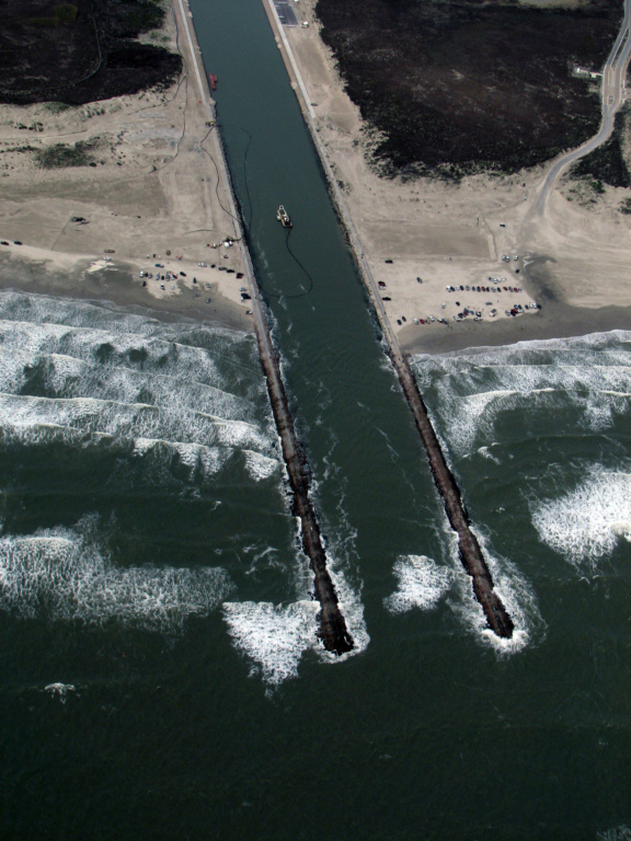
7/18/2011
Diedre Williams, a Coastal Research Scientist from the Conrad Blucher Institute for Surveying and Science told the Island Strategic Action Committee that the dredging is necessary because of large amounts of sand deposited in the channel by Hurricane Ike in 2008.
"The channel was able to cleanse itself of sand until Ike," she said. "Since then sand deposits at the outer end of the channel and on the landward end of the channel have made it impossible for sand to get out. As a result we need to dredge."
Some members of the ISAC questioned whether the sand could be collected on the beach on the southside of the channel to prevent it from blowing into the channel and necessitating dredging. Williams said that approach runs into problems with regulators. "Once you catch sand it becomes a dune and you can't touch a dune," she said.
*********************************************************************
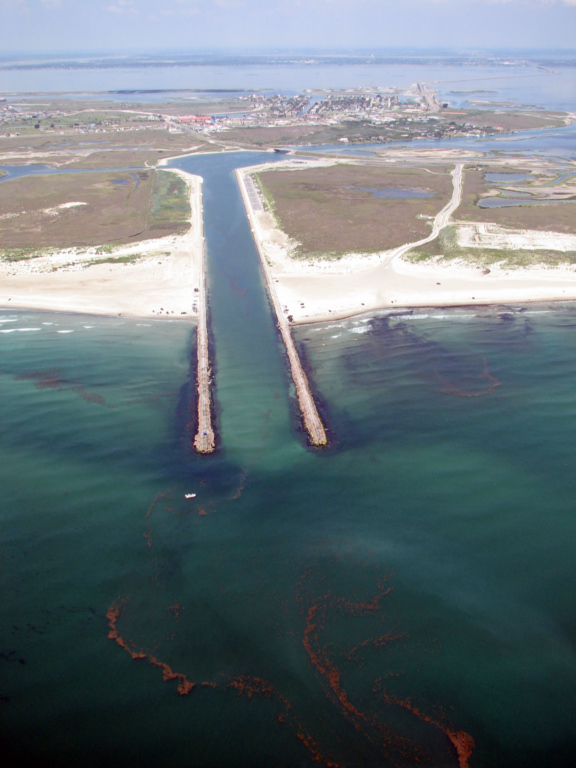
Why is a sand bar forming in Packery Channel?
Packery 9/18/2012
You can
see that the bars on the south (left) side of the Packery entrance are
very well developed by the waves generated by SE winds during the
spring and summer. The outer bar is well beyond the end of the
jetties and can easily transport sand into the channel when it is
active.
Packery 9/18/2012
Packery 9/18/2012
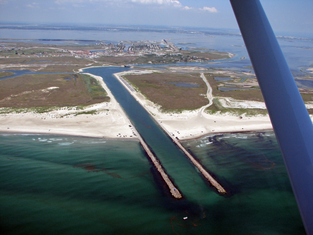
Packery 5/17/2012
The water was exceptionally clear and the bars along the beach and the shallow bar in the entrance of the channel are clearly visible. The outer bar sweeping up from the south out past the end of the Packery Channel jetties feeds large amounts of sand into the mouth of the channel when that bar is breaking.
Packery 5/17/2012
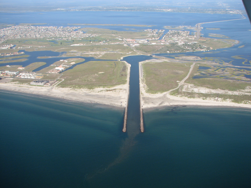
Here you can clearly see the third bar out past the end of the south jetty. The shallow shoal that was not removed by dredging is still in the entrance to the channel and is the site of breaking waves when the surf is up.
Packery 5/17/2012
This shot looking straight up the channel shows the outer bar feeding sand into the channel, the undredged bar in the entrance and also the bars on the north side of the channel that can feed sand into it when waves approach from the east during northers.
Packery 5/17/2012
This photo taken looking south clearly shows the bars.
Packery 2/26/2012
Dredging completed one week after these photos were taken.
Packery 2/26/2012
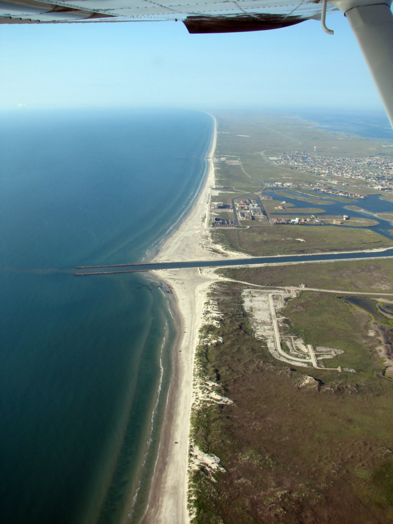
Note the extremely narrow beach between Newport Pass and PackeryPackery 2/26/2012
Even though the dredging is finished, Packery is still breaking in the entrance under low surf conditions.Did they remove the bar at the entrance?
Packery 2/26/2012
12/27/2011
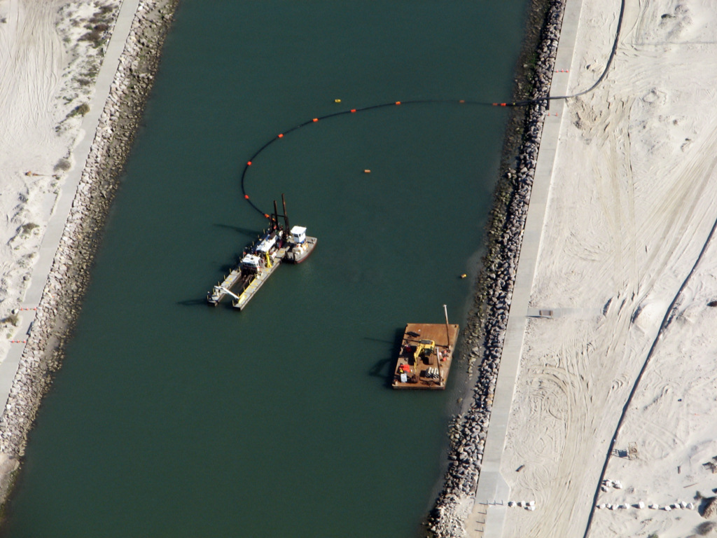
Packery Channel dredging has started.
12/27/2011
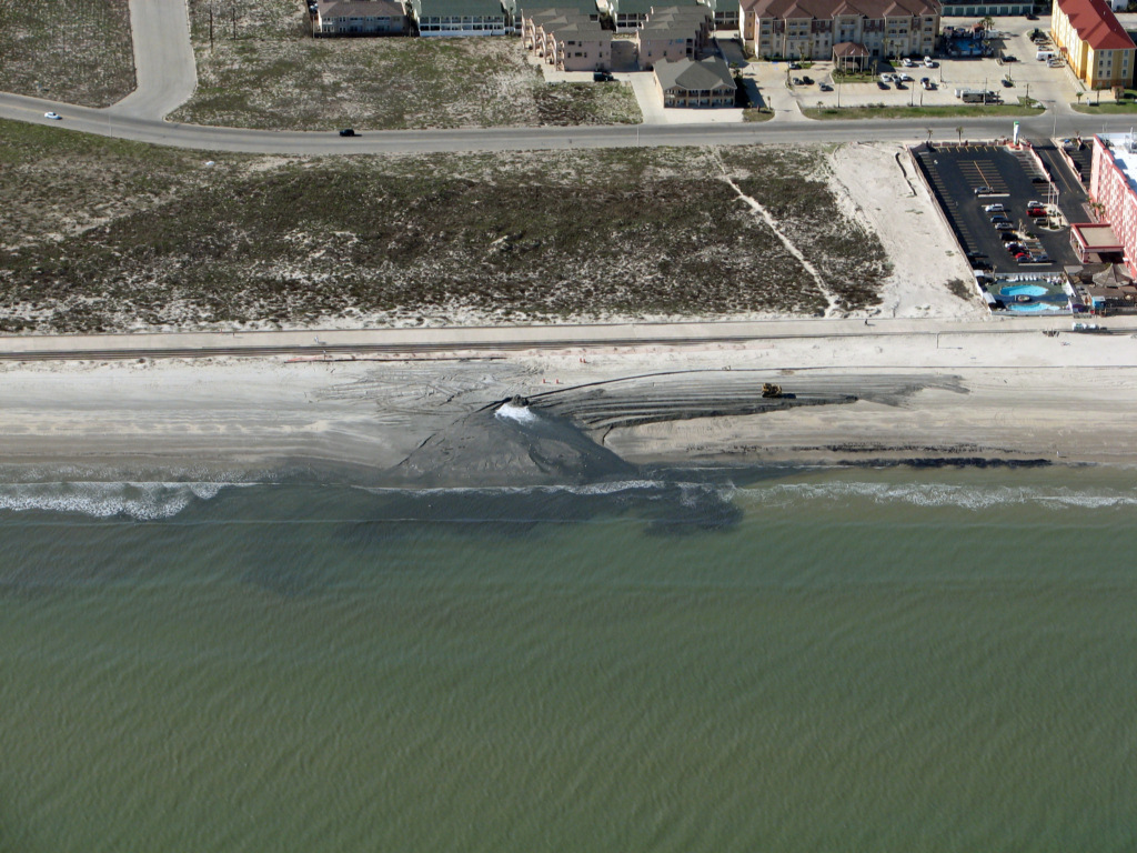
The dredge material disposal is the black spot on the beach in front of the middle of the seawall.
12/27/2011
Dredge material disposal on the beach.12/27/2011
The vessel in the middle of the channel is the small dredge.12/27/2011
Closeup of dredge.12/27/2011
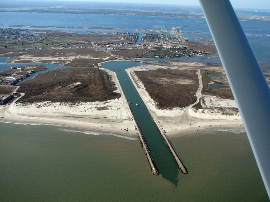
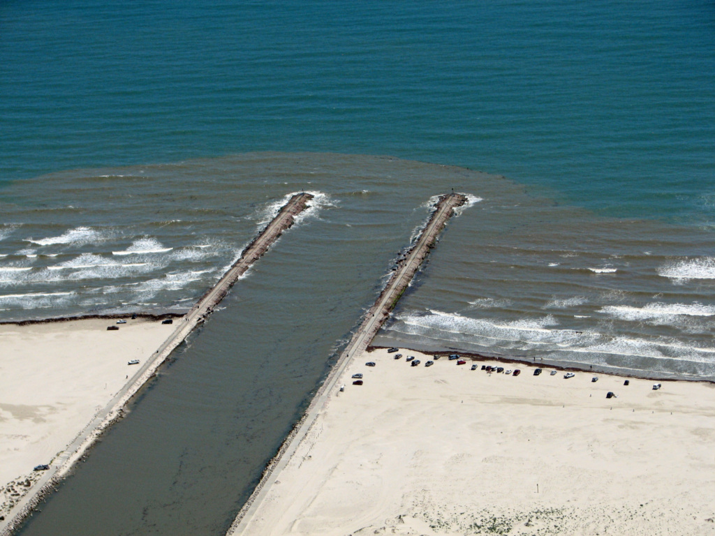
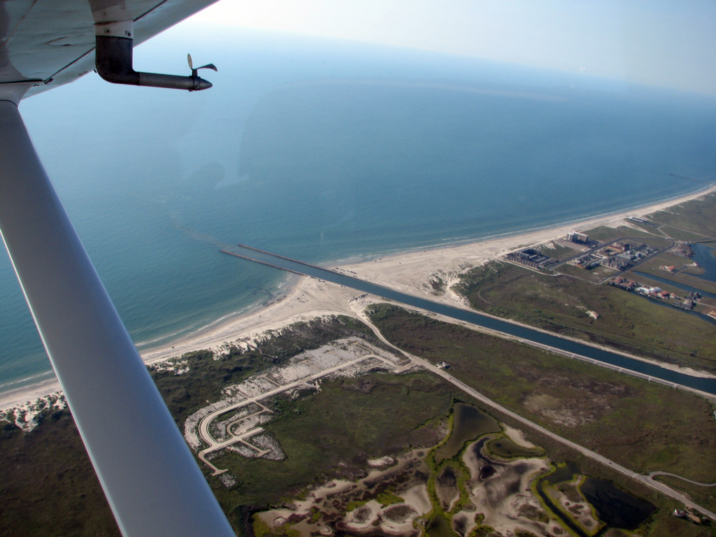
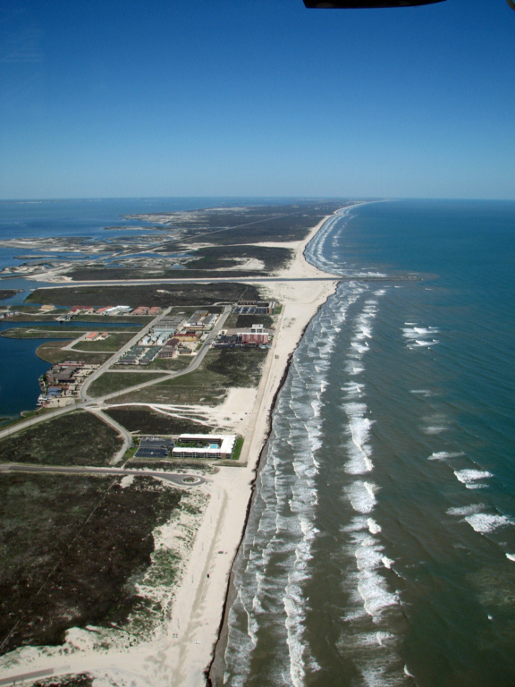
Packery Channel from 5500 ft. altitude.The City of Corpus Christi has applied to the USACE for a permit to dredge Packery Channel and place the sand on the beach in front of the seawall. They plan to dredge about 300,000 cubic yards of material and place it on the beach. The most recent dredging to remove the bar in front of the boat launching area cost nearly $20 per cubic yard. You do the math on this project.
Click here for a copy of the application.
Click here for a copy of the plans.
7/18/2011
Here is an article from the July 15, 2011 Island Moon newspaper. It is re-printed with permission of the Island Moon Newspaper.
Channel
changed since Hurricane Ike
$3.1 Million in Packery Channel Dredging
Scheduled for Late 2011
By Dale Rankin
In the first
large scale dredging since the completion of Packery Channel a project
is scheduled for later this year that will move 280,000 cubic yards of
sand from the bottom of Packery Channel and place it on the portion of
Ellis Beach in front of the seawall from the Holiday Inn to Whitecap.
Diedre Williams, a Coastal Research Scientist from the Conrad Blucher Institute for Surveying and Science told the Island Strategic Action Committee that the dredging is necessary because of large amounts of sand deposited in the channel by Hurricane Ike in 2008.
"The channel was able to cleanse itself of sand until Ike," she said. "Since then sand deposits at the outer end of the channel and on the landward end of the channel have made it impossible for sand to get out. As a result we need to dredge."
She said about 89% of the sand deposited
in the channel is windblown sand rather than sand moved by tides.
Hurricane Ike deposited "several years of sand into the system."
"Since Ike the channel has reached its
capacity of what it can expel during the winter," she said.
A $3.1 million contract for the dredging
is expected to be bid in September and the project will begin soon
afterward. A smaller scale project was completed last year when some
shoaling was occurring near the boat ramps adjacent to S.H. 361 but
this project will be much larger.
Williams and the Institute were
paid $293,400 in the 2001 budget to monitor the depth and overall
condition of the channel. That is a drop from last year when $325,517.
She said the amount was dropped when scientist found they could
adiquately monitor the channel with three surveys each year rather than
four. Williams and the group have been keeping records of the channel
and the area around it since 2003 to find how best to maintain it and
the area around it.
She said that their findings show that the
conditions of the channel can be divided into three distinct season
through the year: The peak summer season when the channel tends to form
shoals just inside the mouth near the end of the south jetty and
sometimes at the outer end of the north jetty. Then in the winter
season a change in the tidal flow cleanses the channel of drift sand
until the beginning of the transitional season in June which leads back
to the summer season.
Monitoring of the channel with sensitive
depth finding gear pulled through the channel by boat also shows that a
twenty-foot hole has formed just at the outer end of the south channel.
Since Hurricane Ike the scouring of the hole by currents provides the
sand that since September of 2010 has formed a permanent sand bar which
runs northward from the tip of the north jetty. Until the flow from the
channel was reduced by the heavy sand deposits left by Hurricane Ike
the current kept this bar from forming but since then it has become a
regular feature.
In September, 2010 a shoaling alert was
issued for boaters after depths as shallow as four to six feet were
found in the basin at the landward end of the channel. The shoal on the
north side of the channel forced water flow to the south side and cut a
deep channel there. However, since then the channel inside the S.H. 361
bridge has widened from 50 to 100 feet due to heavy water flow and this
has meant slower tidal outflow through the channel and has weakened the
channel's ability to cleanse itself of windblown sand.
Williams indicated she believes that once
the dredging is complete the channel will return to its pre-Ike
condition and purge itself of new drift sand.
It was originally thought that the channel
would have to be dredged every two years and a reserve fund of $4
million was to set aside to fund it.
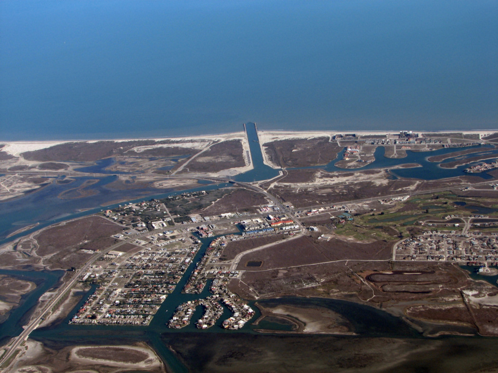
The Packery Channel project established as
a beach re-nourishment project to keep Ellis Beach from narrowing along
the seawall. On Texas beaches where the prevailing winds are from the
southeast beaches located on the south side of jetties normally narrow.
When the original dredging of the channel was done in 2005 the dredge
sand was used increase the width of Ellis beach from under one hundred
feet to more than three hundred. When additional dredging was done in
2010 the sand was deposited primarily on the beach along the northern
half of the seawall where much of it remains and poses a hazard if the
area should be hit with a hurricane tide.
To be an effective hedge against high
tides the seawall needs to be exposed rather than inundated with sand
as it currently is. The sand piled against the seaward side of the wall
allows for incoming high tides to ride up and over the wall and into
adjacent buildings.
"We don't want to repeat the same mistake
as last time," said ISAC member Jim Needam, referring to the placement
of the dredge sand on the northern end of the seawall. "We need to get
it right."
Some members of the ISAC questioned whether the sand could be collected on the beach on the southside of the channel to prevent it from blowing into the channel and necessitating dredging. Williams said that approach runs into problems with regulators. "Once you catch sand it becomes a dune and you can't touch a dune," she said.
Williams said the sand which will be
dredged and placed on the beach is only from the shoaling areas. It is
"beach quaility" sand which has blown into the channel. She said the
bottom sand which lines the main channel is dark due to being mixed
with sargassum weed which finds its way into the channel and sinks to
the bottom. Seperate permits are required for each type of sand and the
bottom sand cannot be deposited on the beach due to its organic makeup.
End of Island
Moon article
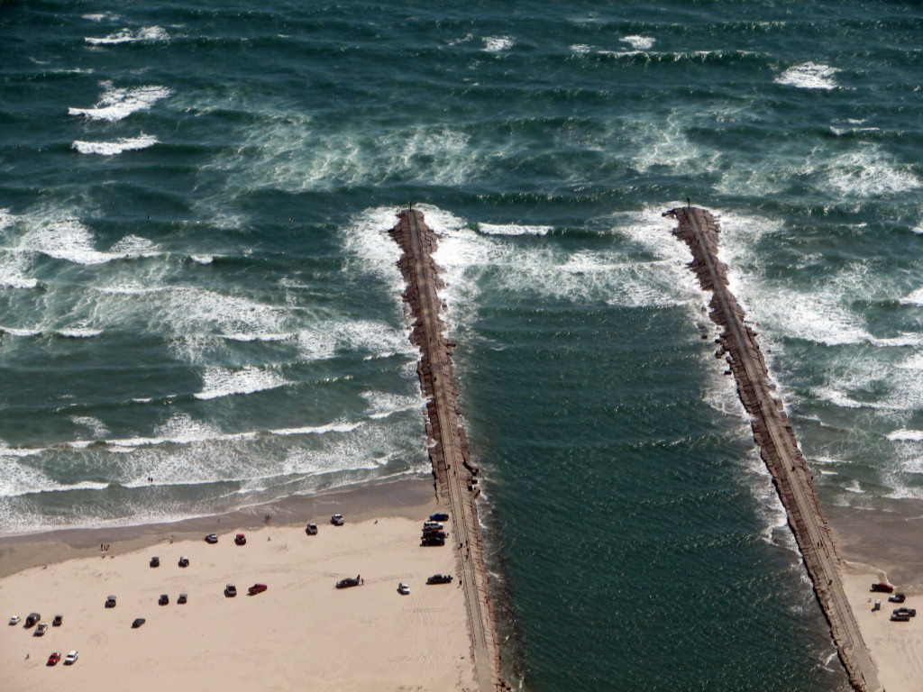
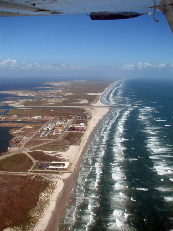
Packery Channel 10/7/2011
Packery Channel 10/7/2011
Packery Channel 10/7/2011
Packery Channel 10/7/2011
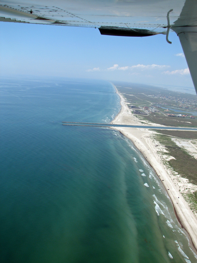
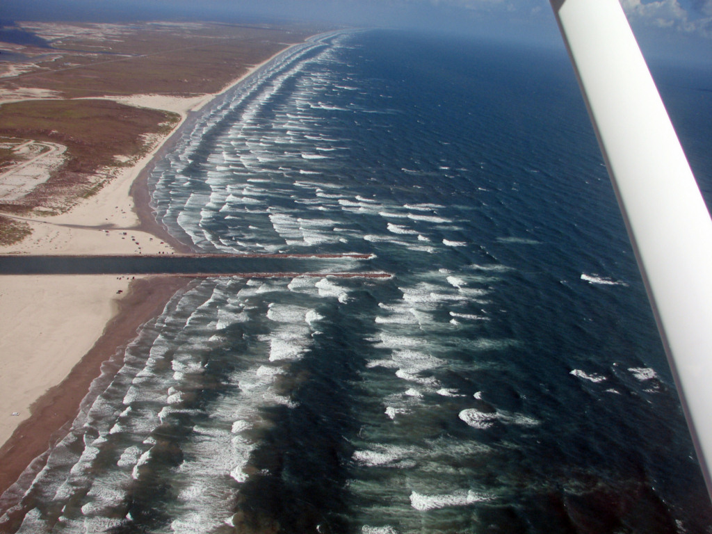
Packery Channel 5/31/2011
The wind today was much less than for the
last several days. In spite of that Packery was breaking a
considerable distance into the entrance. The outer bar south of
the entrance has curved out so that it is now well seaward of the jetty
ends. This means that it will act as a conveyor belt dumping sand
into the entrance whenever there are waves breaking on it generated by
the southeast winds.
Packery Channel 5/31/2011
Here you can see how the outer bar is
seaward of the south jetty. The surf and long shore current is carrying
sand and dumping it right into the entrance. On a flood tide this
will be carried along the channel and deposited.
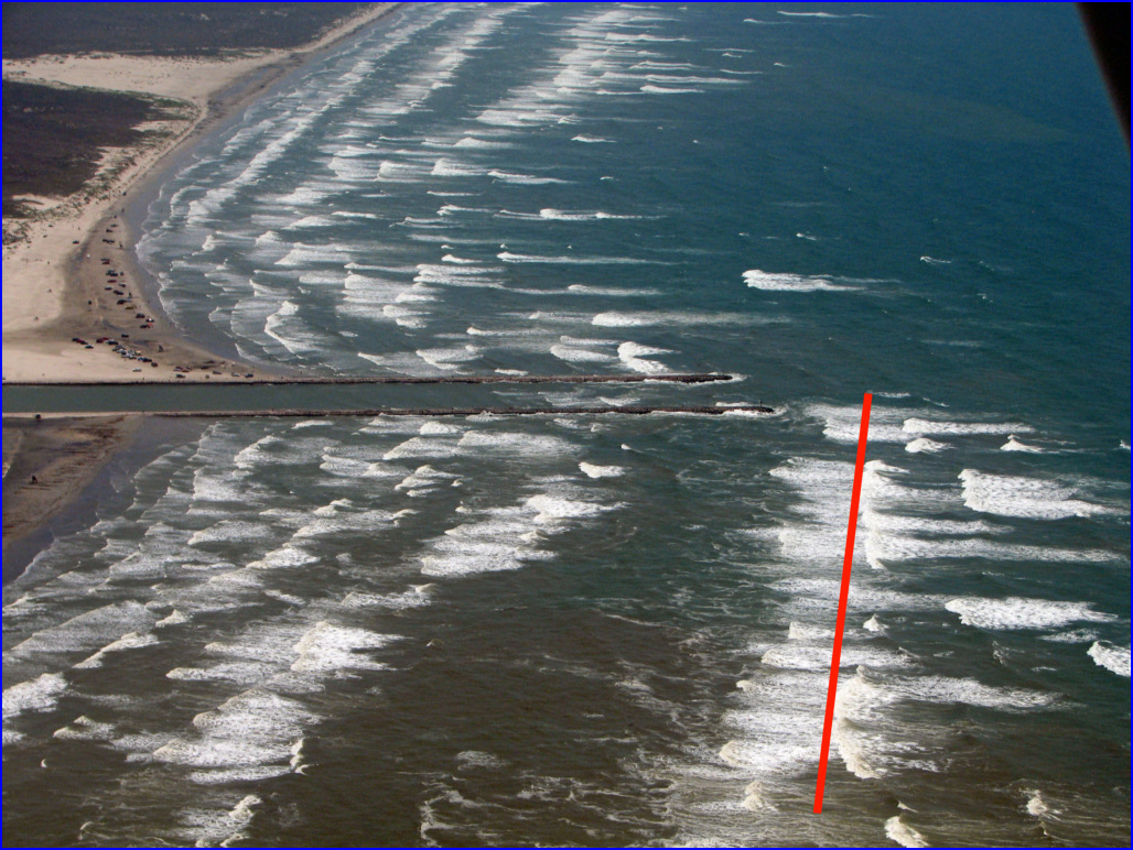
Packery Channel 5/31/2011
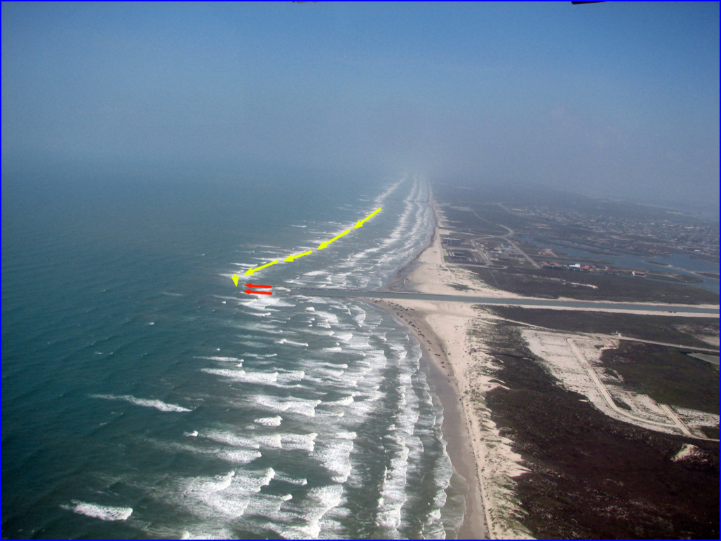
Here you can see how the outer bar is
sweeping offshore at Packery. The build up of sand along the
beaches adjacent to the jetties is not just along the shoreline, but on
out to the maximum depth that wave action can move sand. These
bars will continue to move further offshore as the near shore profile
is raised by accumulation of sand near the jetties. As this
progresses, dredging in the channel will be needed more frequently as
it will fill with sand faster. You can see how sand moves along
the outer bar shown by yellow arrows. The end of the jetties are
shown by red arrows.
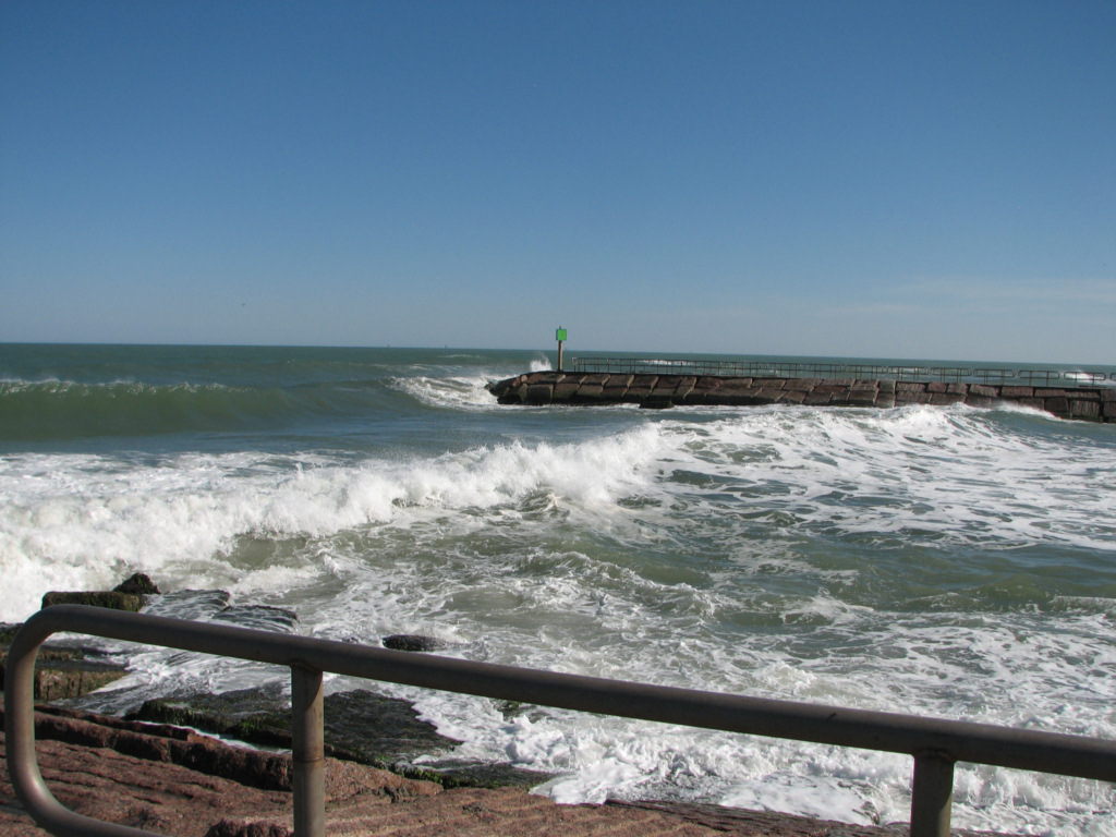
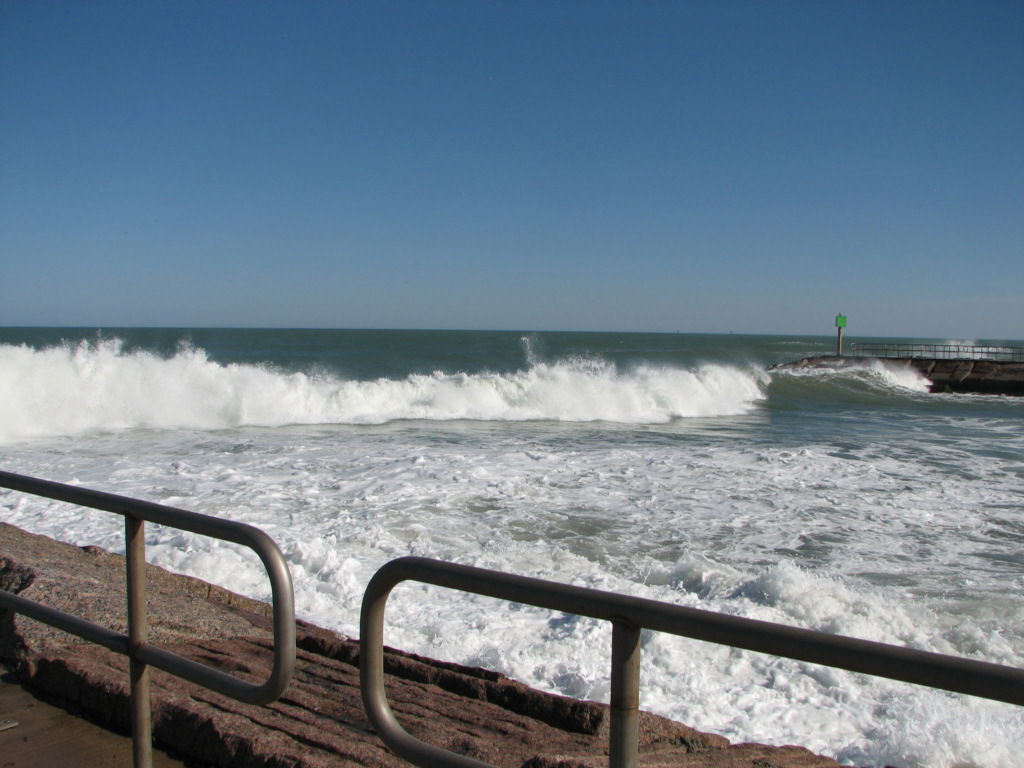
Packery Channel 4/11/2011
Here are two photos of the entrance of
Packery breaking heavily in the waning stages of a norther when the
wind was still blowing offshore. It would have been much rougher
before the norther when the strong SE winds were blowing onshore.
The wave that you see peaking up in the first photo is the
breaking wave in the second photo.
Packery Channel 4/11/2011
Packery Channel 4/5/2011
You can see that the channel entrance is breaking, even though the waves are very small. It is shallow.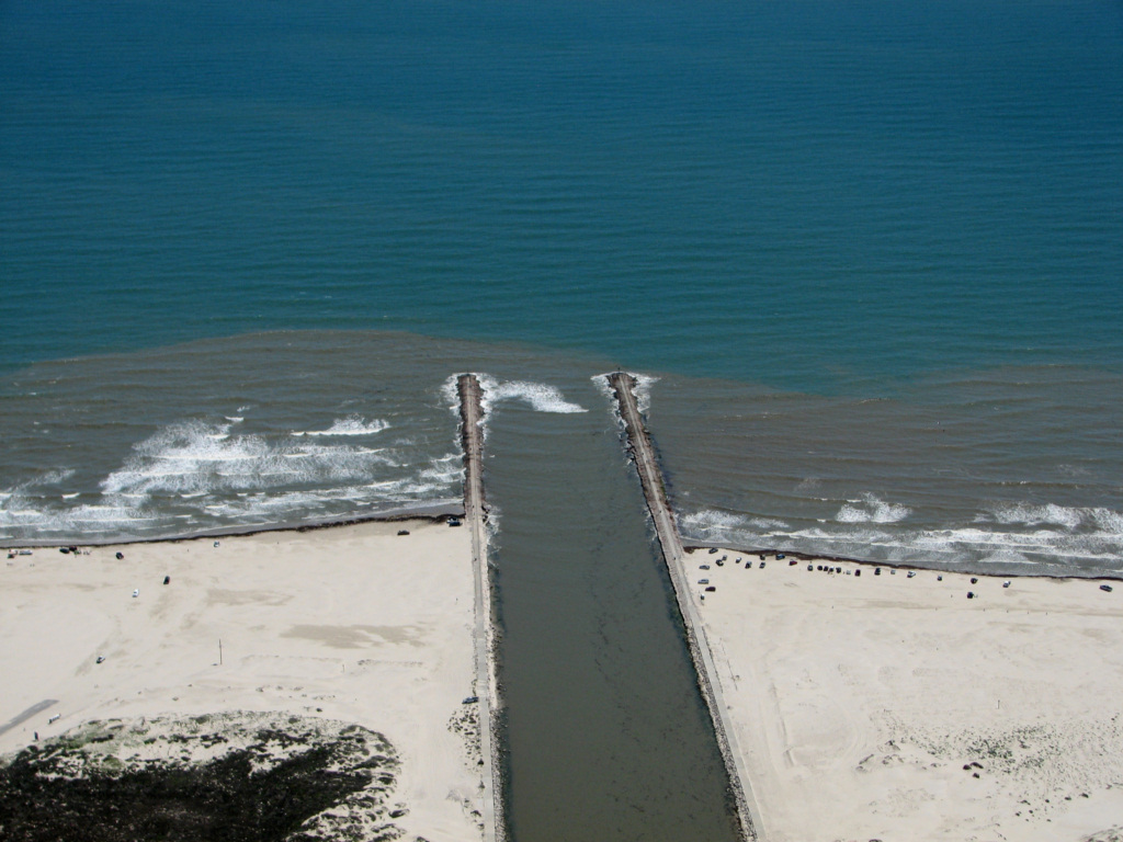
Packery Channel 4/5/2011
Packery Channel 4/5/2011
Packery Channel 4/5/2011
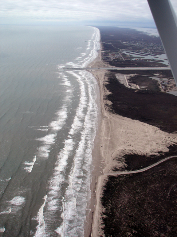
Packery Channel 2/5/2011
Packery Channel 2/5/2011
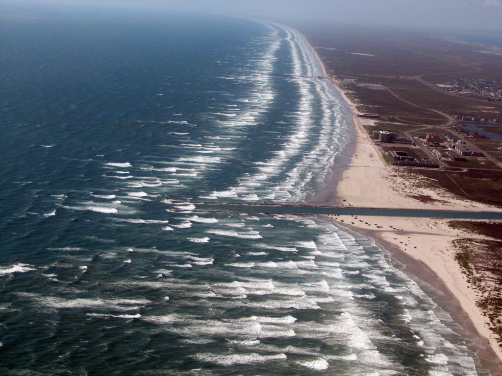
Note the bar that runs from the end of Bob
Hall pier to the end of the south jetty at Packery Channel. This
bar feeds sand into the entrance when the bar is breaking during
southeast and southerly wind directions.
Packery Channel 2/5/2011
Back to Packery Channel Index