


TEXAS
COAST AERIAL
PHOTOGRAPHY
If you want much more information about Packery Channel than is presented on this page go to:
Packery Channel Information
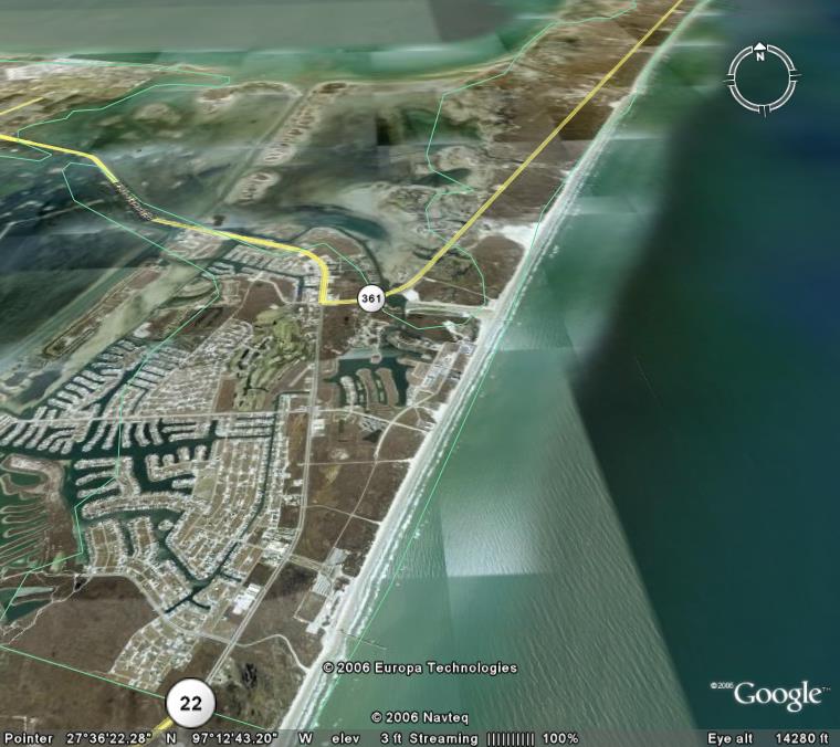
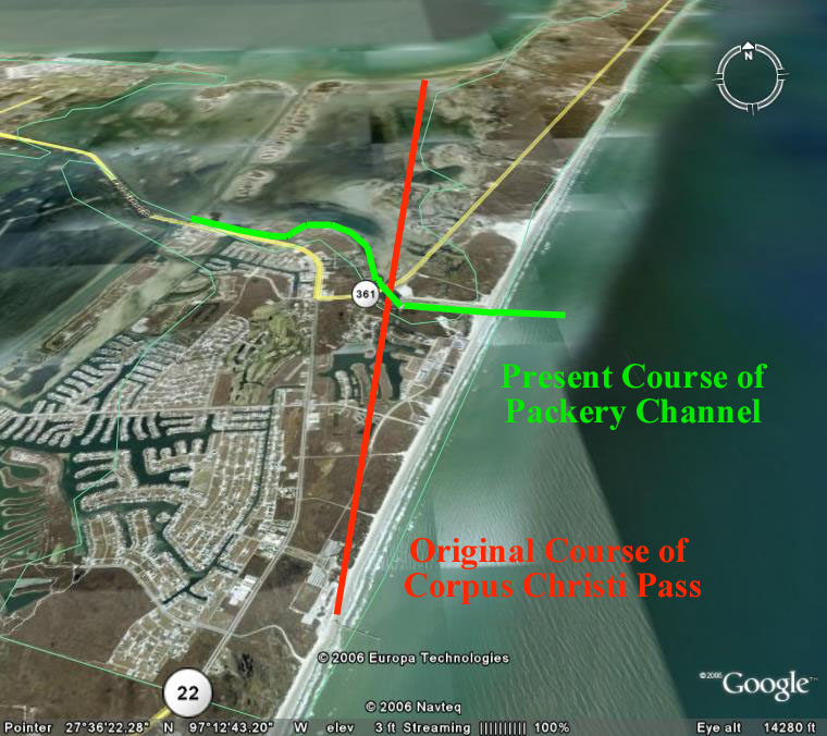
Google Earth Photo showing
CCPass and Packery
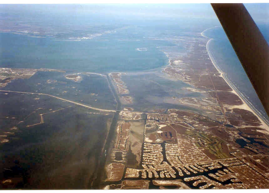
Packery Channel about 1998
Packery Channel to Port Aransas
High resolution digital copies of many of these photographs are available for sale. You may purchase a digital photo in the highest resolution that I have for $25.00 for personal use or for use in your presentations. The charge will be $150 for use in publications or for commercial reproduction. Contact me to purchase photos. These photographs are copyrighted and are the property of Richard L. Watson. They may not be copied or used without permission. You may however link to this website from your website or by email.
These photographs are copyrighted and are the property of Richard L. Watson. They may not be copied or used without permission. You may however link to this website from your website or by email.
If you would like to make a donation to help support the expense of providing these photos of the Texas Coast, please click on the Paypal button below.
Read the following report for much more information about the entire coast.
Coastal Law and the Geology of a Changing Shoreline, March 2006, updated to include section on poor beach and dune management practicesIf you want much more information about Packery Channel than is presented on this page go to:
Packery Channel Information
A Packery Channel and Beach Closing Blog.
Packery.com has had a make-over.
The Dredge Report, a site about Packery Channel.
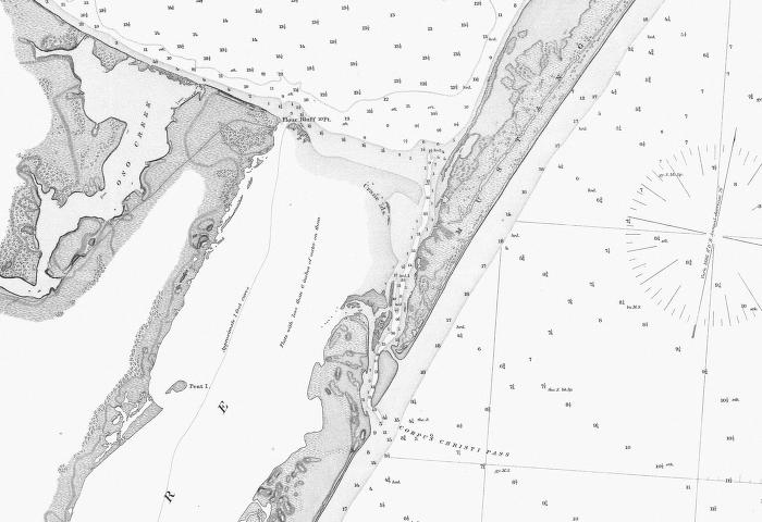
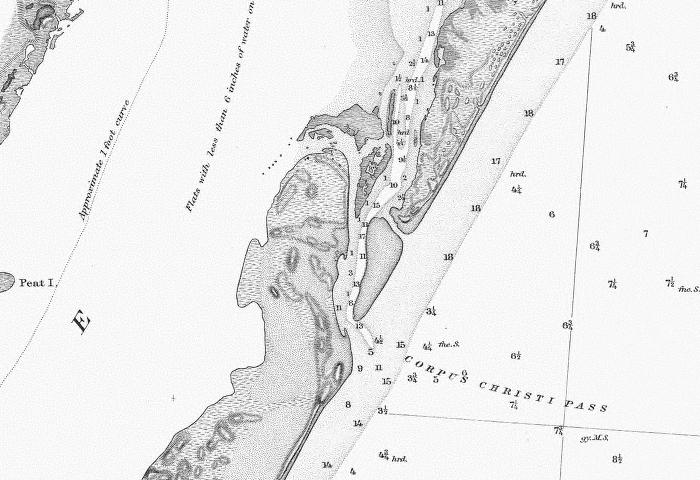
"Packery Channel" in 1887
The
manmade channel now called Packery Channel occupies an ephemeral
hurricane overwash channel. The original pass at that general
location was called Corpus Christi Pass and it ran from about the
location of Bob Hall Pier straight north to Corpus Christi Bay.
It did not in any way follow the present course of the
manmade
Packery Channel. Corpus Christi Pass closed naturally after
the
deep ship channel was dredged from Port Aransas to Corpus Christi in
the 1920s. At the time that the two maps below were printed
Corpus Christi pass was the main entrance to Corpus Christi Bay.
There was no direct shipping channel from Port Aransas to
Corpus
Christi. Ships would enter the relatively deep Aransas Pass,
located across from the light house and proceed north to an anchorage
NE of Harbor Island at Quarantine Shore. There they offloaded
to
small shallow draft "lighters" which proceeded through Corpus Christi
Bayou, a natural channel, and then Morris and Cummings Cut, a dredged
channel, to enter Corpus Christi Bay. Creation of the deep
and
direct channel from Aransas Pass at Port Aransas to Corpus Christi in
the 1920s captured virtually all of the tidal flow in and out of Corpus
Christi Bay and the natural process of longshore drift carrying
hundreds of thousands of cubic yards of sand across the entrance of
Corpus Christi Pass closed it. Lake Padre is a remnant of the
original Corpus Christi Pass. See the Aransas Pass airphoto
page
for corresponding 1887 maps of Aransas Pass, Corpus Chritis Bayou and
Morris and Cummings Cut.
"Packery Channel" in 1887
Google Earth Photo showing
CCPass and Packery
Google Earth Photo without the lines.
Packery Channel about 1998
Packery Channel to Port Aransas
Back to Packery Channel Index